The Pekoe Trail: hiking Sri Lanka’s tea country, stage by stage
The 300 km Pekoe Trail through Sri Lanka’s tea hills – trail status, the best day stages and how we fit them into a round trip.
Updated: 18 October 2026, 7 min read
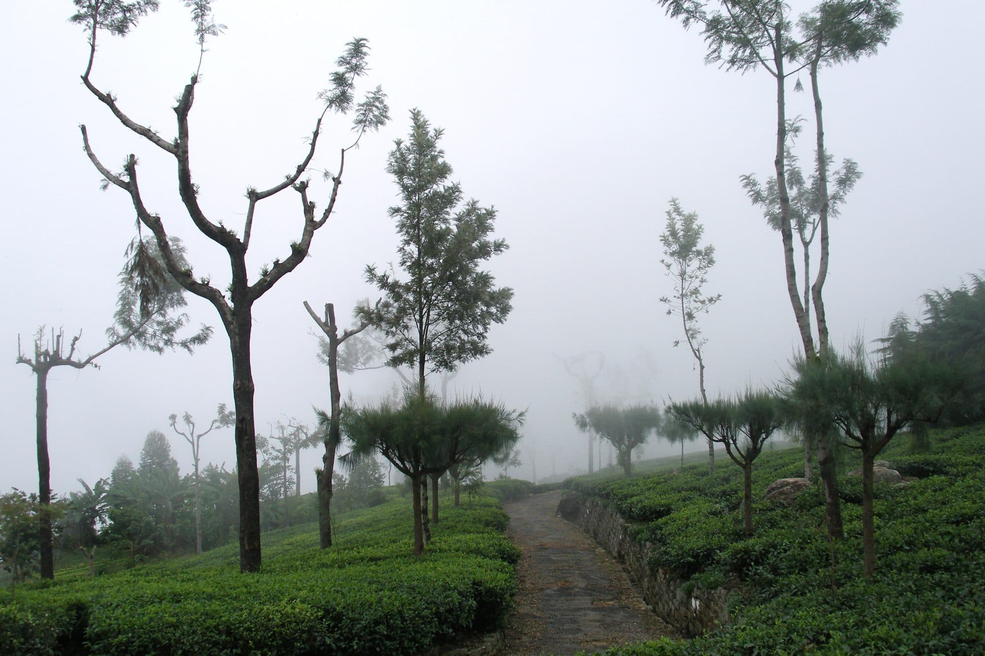
The Pekoe Trail is a waymarked walking route of about 300 km through Sri Lanka’s tea country, split into 22 stages from Hanthana near Kandy to Pedro Estate near Nuwara Eliya. You need no permit: walking is free, and the official trail pass (a suggested US$10 per stage for overseas visitors) is a voluntary contribution. Most travellers walk one to four day stages, for example Ella to Demodara past the Nine Arches Bridge, while their driver takes the luggage to the next hotel.
What is the Pekoe Trail?
The trail links old tea-estate tracks, village footpaths and forest paths in the Kandy, Nuwara Eliya and Badulla districts. It passes through the tea valleys near Hatton, crosses Horton Plains, continues via Haputale and Ella, loops through the Uva hills and ends near Nuwara Eliya. Each stage is 9 to 21 km long and takes three to six hours. Walking all 22 stages takes 16 to 22 days.
A not-for-profit company runs the trail and its app. Most stages have signposts and an information board at the trailhead, but the waymarking is not complete, so use the official app or a GPS track as a backup.
Is the Pekoe Trail open after Cyclone Ditwah?
Mostly, yes. Cyclone Ditwah in late November 2025 brought down trees, damaged paths and caused landslides along the trail. The trail team has since cleared and repaired most sections. Stage 4 reopened after restoration work in the first half of 2026, and on Stage 3 hikers take short bypasses around two spots the cyclone damaged.
Status on 17 October 2026, from the official website:
- Closed: Stage 2 (Galaha – Loolkandura), after landslides damaged a forest section. An alternative route is being prepared.
- Amber alert: Stages 3, 4, 7, 9, 12, 18, 19 and 20, because of monsoon rain.
- Yellow advisory: all other stages. They are open, but expect wet and slippery paths.
The status changes with the weather. Check the official stage pages on the morning you walk.
Do you need a pass or permit?
No permit is needed, and nobody checks passes on the trail. The official trail pass is voluntary: the suggested contribution for overseas visitors is US$10 per stage (checked October 2026). You buy it in the Pekoe Trail app or on the trail’s web portal. It pays for maintenance and signs, and it unlocks the offline map of that stage in the app for the day you walk. Phone signal is poor on many stages, so the map alone makes it worth buying.
The pass does not cover Horton Plains National Park (Stages 10 and 11), which sells its own ticket.
Which Pekoe Trail stages are best on a round trip?
With one to three days for hiking, choose stages around Haputale and Ella or near Nuwara Eliya. They start and end close to good hotels.
| Stage | Route | Length | Time | Official level | Highlights |
|---|---|---|---|---|---|
| 16 | Ella – Demodara | 9.5 km | about 3 h | easy | Nine Arches Bridge, tea estate, Demodara Loop |
| 15 | Makulella – Ella | 9.6 km | about 3 h | moderate | top of Ella Rock, eucalyptus forest |
| 13 | Haputale – St Catherine’s | 14.6 km | about 4 h | moderate to hard | forest, Dambatenne valley, view of Lipton’s Seat |
| 22 | Kandapola – Pedro Estate | 11.3 km | about 4.5 h | moderate | two tea factories, Lover’s Leap waterfall |
Lengths and times from the official stage pages (checked October 2026).
- Stage 16 is the easiest and a good first stage. It starts at Ella station, passes the Nine Arches Bridge and ends near Demodara station, where the railway spirals around a hill. Our guide to Ella covers the sights on the way.
- Stage 15 climbs Ella Rock from the quiet side and ends at Ella station. The last 1.5 km follows the railway from Kithal Ella. Trains run on this line again (see the train to Ella), so step well off the tracks when you hear one.
- Stage 13 has about 810 m of ascent and some of the widest views on the trail. Strong walkers can add a 3 km detour to Lipton’s Seat.
- Stage 22 is mostly open tea-estate track with almost no shade for about 8 km. It passes the Court Lodge tea factory, founded in 1890, and ends about 3 km from the centre of Nuwara Eliya.
With three days, walk Stages 13, 14 and 15 from Haputale to Ella, about 34 km in total. Stage 14 is mostly downhill.
How a private driver makes it easy
Many stages start and end in villages with no hotel, no taxi and little phone signal. This is where your own car and driver help most:
- Your driver drops you at the trailhead after breakfast and takes your luggage to the next hotel. You walk with a daypack.
- You agree on a pick-up point and a latest time before you start. The road is often much longer than the path: from Dayagama to Horton Plains it is about 16 km on foot but about 65 km by road, so your driver usually waits for you.
- If the weather turns, he can meet you where the trail crosses a road.
On our active round trip and our 14-day classic round trip we can swap a sightseeing morning for a stage, or add a day for a longer one. Our private round trips cost from US$100 per person per day (2 people sharing, 3-star hotels with breakfast). Trail passes, guides and entrance fees are extra.
When is the best time to hike the Pekoe Trail?
The trail is open all year. The organisers name December to April and July to September as the best months. In more detail:
- February and March are usually the most reliable months on the whole trail.
- June to August suit the eastern stages around Ella and Demodara, which are usually dry then, while Nuwara Eliya and Horton Plains get south-west monsoon rain.
- October to December are the wettest months, with leeches, slippery paths and a higher risk of landslides.
Above 1,500 m, mornings and evenings are cool and often misty. Our hill country guide explains the region’s seasons.
What should you bring?
- Leech socks, ideally bought before you travel
- A light rain jacket for afternoon showers
- 1.5 to 2 litres of water per person, and snacks; filter or treat stream water
- Walking shoes with good grip
- Sun protection, as some stages have hours without shade
- Small cash for drinks, a tea factory or the Lipton’s Seat fee
- A charged phone with the Pekoe Trail app and the stage map
- Clothes that cover shoulders and knees for villages and temples
Do you need a guide, and is it safe?
A guide is not required, but the organisers recommend one, especially on remote forest stages. A local guide knows the turns where walkers get lost and can tell you about the estates you pass. We can arrange a guide on request.
The trail’s own safety rules (checked October 2026):
- Start no earlier than 7 am and finish by 5 pm.
- Don’t walk alone in forest sections.
- Check the stage status and the weather first, and don’t walk in thunderstorms.
- Ask before you photograph tea pluckers or homes, and don’t pick tea.
- In an emergency, call 1990 for the national ambulance service.
Check that your travel insurance covers hiking.
Want to see this yourself?
Tell us your dates and what you like. Ravindu or one of our team will send you a personal route and price, usually within 24 hours.
Private round trips from US$700 per person for 7 days
FAQ
How long is the Pekoe Trail?
About 300 km in 22 stages, from Hanthana near Kandy to Pedro Estate near Nuwara Eliya. All of it takes 16 to 22 days; most visitors walk one to four stages.
Is the Pekoe Trail free?
Yes, walking is free. The trail pass, a suggested US$10 per stage for overseas visitors, is voluntary but unlocks the offline stage map in the official app.
Which stage is best for beginners?
Stage 16 from Ella to Demodara: 9.5 km, about three hours and rated easy, with the Nine Arches Bridge on the way.
Can you hike the Pekoe Trail without a guide?
Yes, if you are used to hiking and navigate with the official app or a GPS track. On remote forest stages a local guide is safer.
Is the Pekoe Trail open after Cyclone Ditwah?
Mostly. On 17 October 2026 only Stage 2 was closed; the other stages were open with weather alerts.